France · French Alps · Dauphiné
Col du Galibier — 2,642 metres above the Maurienne
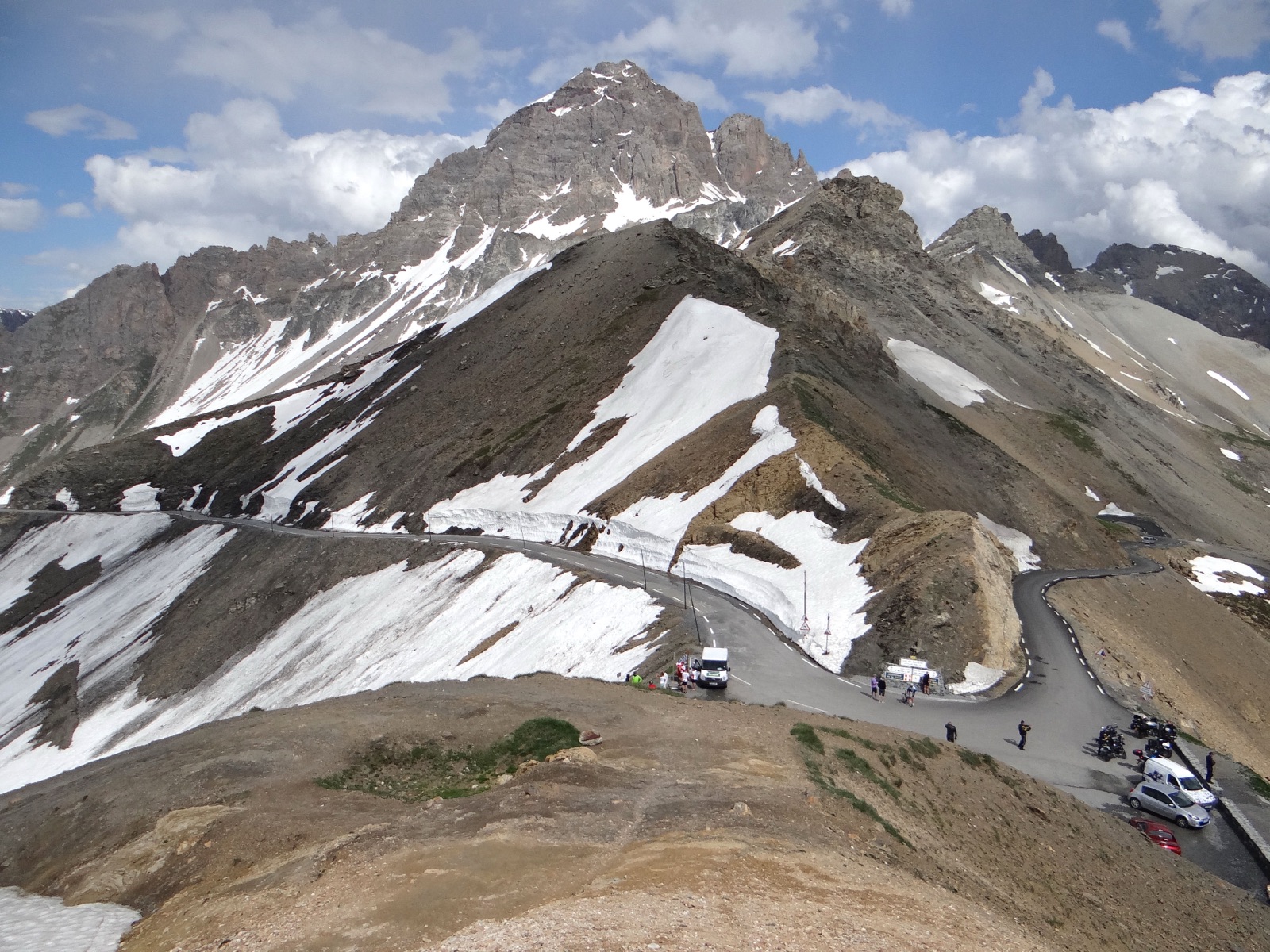
Profile of the Col du Galibier — 2,642m in the French Alps, a Tour de France fixture since 1911, and the highest point of the Route des Grandes Alpes.

The Galibier is the high point of the Route des Grandes Alpes and a fixture on the Tour de France since 1911. At 2,642 metres it is tall enough to feel the thinning of the air, and long enough, paired with the Télégraphe that precedes it, to be one of the Tour's classic two-act climbs.
History
A monument to Henri Desgrange, the founder of the Tour de France, sits near the summit. When the Tour first crossed the Galibier in 1911, Émile Georget was the only rider who didn't get off and walk. A tunnel built in 1890 allowed year-round crossings at 2,556 metres; the road was extended over the actual summit in 1976.
Riding it
The full ride from Saint-Michel-de-Maurienne strings together the Col du Télégraphe (12 km at 7%), a short descent into Valloire, and then the Galibier proper (18 km at 7%). The final two kilometres kick above 10%, just when you need them not to. From the south, the climb begins at Briançon via the Col du Lautaret and is gentler but still substantial.
Along the way
- Henri Desgrange monument — A stone memorial near the summit honouring the founder of the Tour de France, who first sent riders over the Galibier in 1911.
- Galibier tunnel — The original 1891 tunnel at 2,556 m that allowed year-round passage before the summit road was extended over the top in 1976.
- Col du Lautaret alpine garden — A botanical garden at 2,100 m on the southern approach, run by the University of Grenoble since 1899, with over 2,000 high-altitude plant species.
- Valloire village — The small ski town in the valley between the Télégraphe and the Galibier, the natural rest stop and last café before the final 18 km to the summit.
- Col de l'Iseran — The Route des Grandes Alpes neighbour to the north, often ridden as a same-trip pairing.
- Col Agnel — The quieter alternative to the south, a natural three-pass multi-day extension from the Briançonnais.