France · French Alps · Mercantour
Col de la Bonette — 2,802 metres, the roof of France
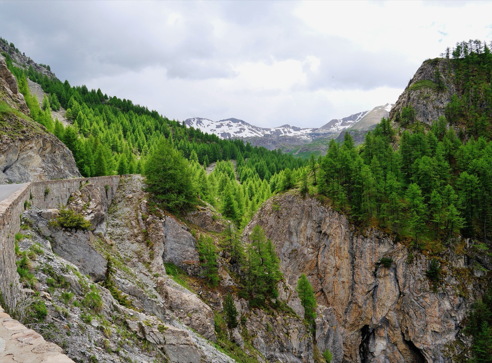
Profile of the Col de la Bonette — 2,802m summit loop, one of the highest paved roads in Europe, above the Mercantour in southern France.

The Bonette is France's trump card in the "highest paved road in Europe" argument. The actual col sits at 2,715 metres, but a loop around the Cime de la Bonette climbs a further 88 metres to 2,802, enough to edge past the Iseran and lay claim, with some asterisks, to the top of the continent.
History
The summit loop was built deliberately above the pass itself so France could win this argument. The road was paved in 1961; an older military road served the same alignment for decades before that. On a clear day you can see the Matterhorn and the Mediterranean from the same summit marker.
Riding it
From Saint-Étienne-de-Tinée in the south, the climb is 23.8 km of wide, constantly curving road that avoids the low-altitude traffic that plagues the Alps in summer. The top four kilometres are above the tree line and properly cold; the summit loop passes old military bunkers before dropping you back onto the col. Weather here can turn quickly, so carry layers even in August.
Along the way
- Cime de la Bonette loop road — The narrow one-way loop above the col itself, climbing an extra 88 metres around the summit cone to 2,802 m and the marker that claims the highest road in Europe.
- Camp des Fourches — Ruins of a Second World War military camp on the northern descent, built into the mountainside at 2,300 m and still partially standing.
- Jausiers — A quiet Provençal village on the northern side in the Ubaye valley, the traditional starting point for the Bonette climb and the last place to fill bottles.
- Col de l'Iseran — The rival for the "highest paved pass in France" title, the one the Bonette loop was engineered to overtake.
- Col du Galibier — The high point of the Route des Grandes Alpes, the classic French multi-pass itinerary that leads here.