Peru · Lima · Central Andes
Ticlio (Abra de Anticona) — the high point of Peru's Central Highway
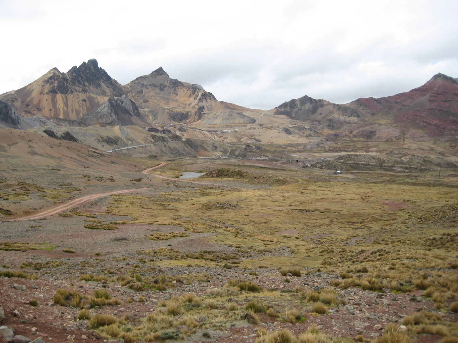
Profile of Ticlio, officially Abra de Anticona — 4,818m on the Carretera Central between Lima and Huancayo, one of the highest paved through-roads in the Americas.
.jpg)

Ticlio, officially Abra de Anticona, is the high point of the Carretera Central (PE-22), the paved highway that climbs from Lima at sea level to the central Andean cities of La Oroya and Huancayo. The pass reaches 4,818 metres (15,807 feet) and is one of the highest paved through-roads in the Americas, carrying daily truck traffic from the Pacific ports to the copper smelters of the central sierra.
History
The highway was opened in stages through the 1920s and 1930s, essentially following the alignment of the Ferrocarril Central Andino, once the highest standard-gauge railway in the world. The railway and the road share the same valleys and the same two-day climb from the coast, crossing each other repeatedly and tunnelling side by side below the summit. Asphalt reached Ticlio in the 1950s and has been maintained since.
Riding it
From Lima the ascent is a relentless 4,800 metres in 175 kilometres, with only brief flat sections at Chosica and Matucana. Altitude sickness (soroche) is common for travellers who have not acclimatised, and buses carry oxygen as standard. Trucks crawl the steep sections and overtaking is the main hazard.
The summit is broad and marked by a large concrete archway. A small stone-and-wood town called Ticlio sits in the saddle, with tea stalls, a railway halt, and a few mining-company offices. The eastern descent to La Oroya is shorter and drier than the Pacific side.
Along the way
- Ticlio archway — the concrete summit marker on PE-22, the standard photo stop.
- Ticlio town — a handful of tin-roofed buildings at 4,800 m with hot mate and coca tea.
- Ferrocarril Central Andino — the highest standard-gauge railway in the world, sharing the pass with the road.
- La Oroya — mining and smelting town at the east foot, 3,750 m.
- Lake Junín — high-altitude wetland on the plateau east of the pass, rich with puna birdlife.