United States · Colorado · Front Range
Mount Blue Sky — North America's highest paved road
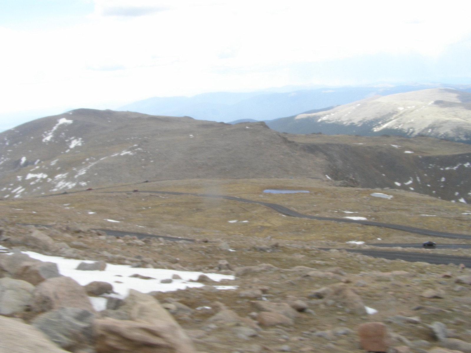
Profile of the Mount Blue Sky Scenic Byway (formerly Mount Evans) — 4,348m in Colorado, the highest paved road in North America when open.

The Mount Blue Sky Scenic Byway is the highest paved road in North America, topping out at 4,348 metres (14,264 feet) on the summit ridge of Mount Blue Sky in Colorado's Front Range. The road was renamed from Mount Evans in 2023, following a decision by the US Board on Geographic Names to remove the name of a nineteenth-century Colorado governor connected to the Sand Creek Massacre.
History
The highway was built between 1917 and 1930 as part of Colorado's early scenic-roads programme, originally reaching only to Summit Lake before being extended to the top ridge. At the summit was a stone crater observatory, since dismantled. The road sits almost entirely within the Mount Blue Sky Wilderness and is closed to commercial traffic.
2026 reopening
The byway was closed above Summit Lake from September 2024 through spring 2026 for drainage and pavement repair after severe freeze-thaw damage. Denver Parks and Recreation has taken over management from the US Forest Service, and the upper road reopens to the summit on 22 May 2026, Memorial Day weekend. Entry is by timed reservation on recreation.gov, with fees of around $20 per car and $15 per motorcycle.
Riding it
From Idaho Springs on Interstate 70, Colorado 103 climbs to Echo Lake Lodge at 3,230 metres, and Colorado 5 takes over for the 14-mile ascent to the summit. The grade is moderate (around 7%) but the altitude is the defining factor, and the top ten switchbacks have no guardrails on the drop side. The Colorado bighorn sheep that live on the summit ridge often stand in the road.
Along the way
- Echo Lake Lodge — 1926 stone lodge at 3,230 m, the traditional starting point of the summit climb.
- Summit Lake — glacial lake at 3,926 m, the highest highway-accessible lake in the US.
- Summit crater observatory ruins — stone foundation on the summit, the remains of a 1930s astronomy station.
- Mount Blue Sky Wilderness — 304 km² federally designated wilderness surrounding the peak.
- Pikes Peak Highway — the second-highest paved road in North America, 80 km south on the Front Range.