United States · Colorado · Front Range
Pikes Peak Highway — 4,302 metres and "America's Mountain
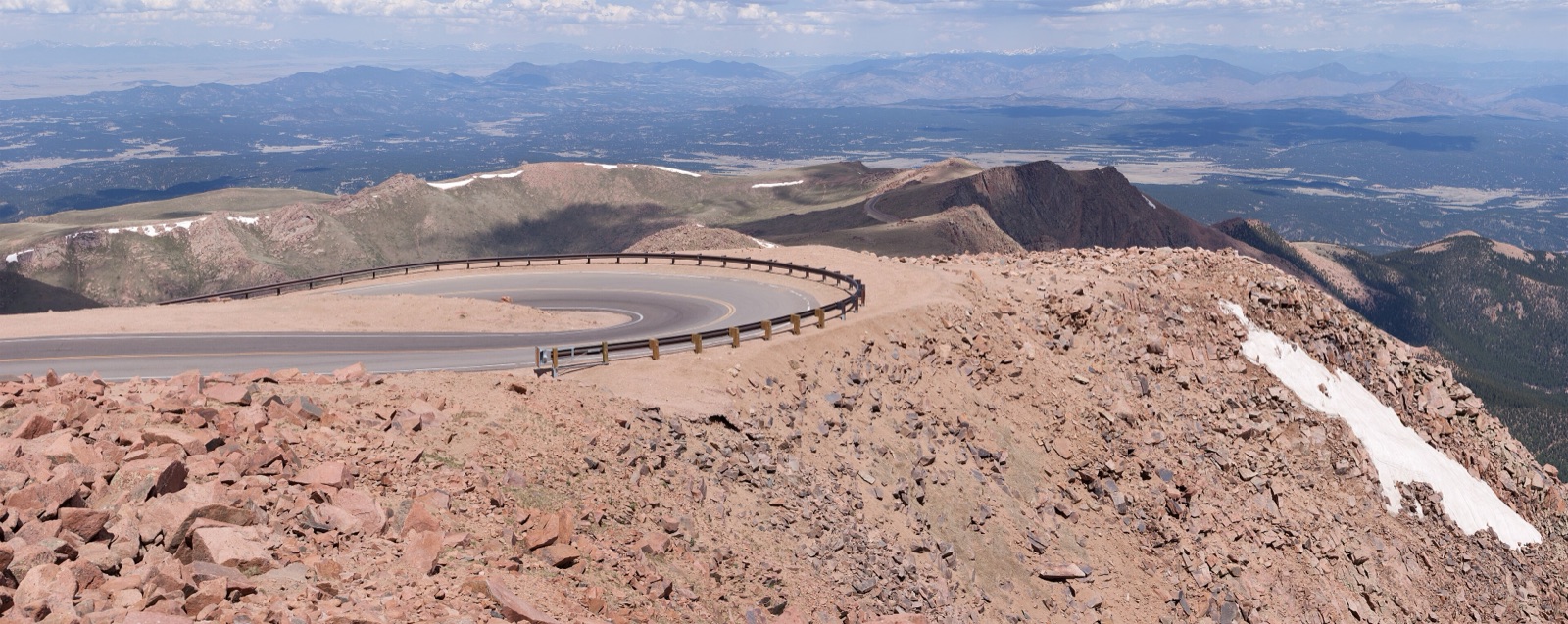
Profile of the Pikes Peak Highway — 4,302m in Colorado, the second-highest paved road in North America and home of the Pikes Peak International Hill Climb.
_(5911317563).jpg)

The Pikes Peak Highway climbs 31 kilometres from Cascade, Colorado, to the 4,302-metre (14,115-foot) summit of Pikes Peak on the eastern edge of the Rocky Mountains. It is the second-highest paved road in North America after Mount Blue Sky, and the venue for the Pikes Peak International Hill Climb, the second-oldest motor race in the United States.
History
The road was opened in 1915 as a toll route after automobile pioneer Spencer Penrose paid for the upgrade of an older carriage track. The first Pikes Peak International Hill Climb was held in 1916 and has run nearly every year since, with both cars and motorcycles. The full 20-mile course was finally paved end to end in 2011, after a decade of environmental lawsuits over dust and runoff. A new Summit Complex visitor centre was opened in 2021.
Riding it
The road is open year-round to passenger vehicles, though the upper reaches close frequently in winter for snow and ice. The gradient averages 7% with 10% pitches in the Glen Cove switchbacks. Brake fade is a real issue on the descent; the operator runs mandatory brake-temperature checks at a halfway station, and drivers failing the check are required to cool their vehicles before continuing.
From the summit the view takes in the Sangre de Cristo range to the south and the plains of eastern Colorado to the east. The 1893 visit of Katharine Lee Bates to the summit is credited with inspiring the lyrics of "America the Beautiful".
Along the way
- Glen Cove — midpoint stop at 3,520 m, with a café, a ranger station, and the mandatory brake-check for descending vehicles.
- Crystal Reservoir — fishing lake at 3,000 m on the lower highway, popular family stop.
- Devil's Playground — treeline bend at 3,900 m, named for the static electricity on the exposed ridge.
- Summit Complex — 2021 visitor centre with the highest commercial doughnut kitchen in the US at 4,302 m.
- Pikes Peak International Hill Climb — annual race up the full highway, usually the last Sunday in June.