New Zealand · Otago · Mackenzie · Southern Alps
Lindis Pass — the tussock saddle between Otago and the Mackenzie
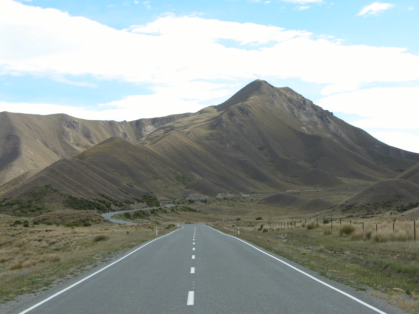
Profile of Lindis Pass — 971m on State Highway 8, the classic tussock crossing of inland Otago between Tarras and Omarama.

Lindis Pass is the main road link between Central Otago and the Mackenzie Basin, a long gradual climb through continuous golden tussock country to 971 metres at the saddle. It is the highest point on State Highway 8, the classic inland route from Queenstown to Christchurch, and one of the most recognisable landscapes in New Zealand: nothing but tussock, sky, and road.
History
The Lindis corridor was used as a stock route through the 1850s gold-rush era, moving sheep and supplies between the Otago goldfields and the Canterbury plains. A telegraph line followed in the 1860s, the road was formed in the early 1900s, and SH 8 reached its modern alignment in the 1950s.
The pass sits within the Lindis Pass Scenic Reserve, protecting one of the largest areas of unbroken native tussock grassland left in New Zealand. Fescue and red tussock dominate; above about 1,000 m the vegetation shifts to snow tussock.
Riding it
The climb is the definition of gradual: around 600 metres of gain spread over 35 kilometres from the south, almost never exceeding 7%. The reward is the landscape rather than the gradient: rolling gold hills in every direction, the Dunstan Mountains to the west and the Hawkdun Range to the east. The descent to Omarama on the north side drops into the Mackenzie Basin and opens onto the Aoraki/Mt Cook horizon.
In winter the pass is kept open but chains can be required above about 800 metres. In autumn the tussock turns copper, making late April one of the best times to ride it.
Along the way
- Lindis Pass summit lookout — signed pullout with interpretation and the iconic long view over unbroken tussock.
- Clay Cliffs of Omarama — 30 m badlands formations on private land with honesty-box access, 10 km west of Omarama.
- Omarama — small service town at the north foot, hot pools, and the usual fuel stop before Lake Pukaki.
- Tarras — wool-country village at the south foot with a farm shop and café.
- Crown Range — the Queenstown–Wanaka crossing, usually paired with Lindis on a South Island loop.
- South Island High Country loop — the three-pass circuit from Queenstown.