New Zealand · Otago · Southern Alps
Crown Range — New Zealand's highest sealed main road
Profile of the Crown Range Road — 1,076m, the highest sealed main road in New Zealand, linking Queenstown and Wanaka via Cardrona.
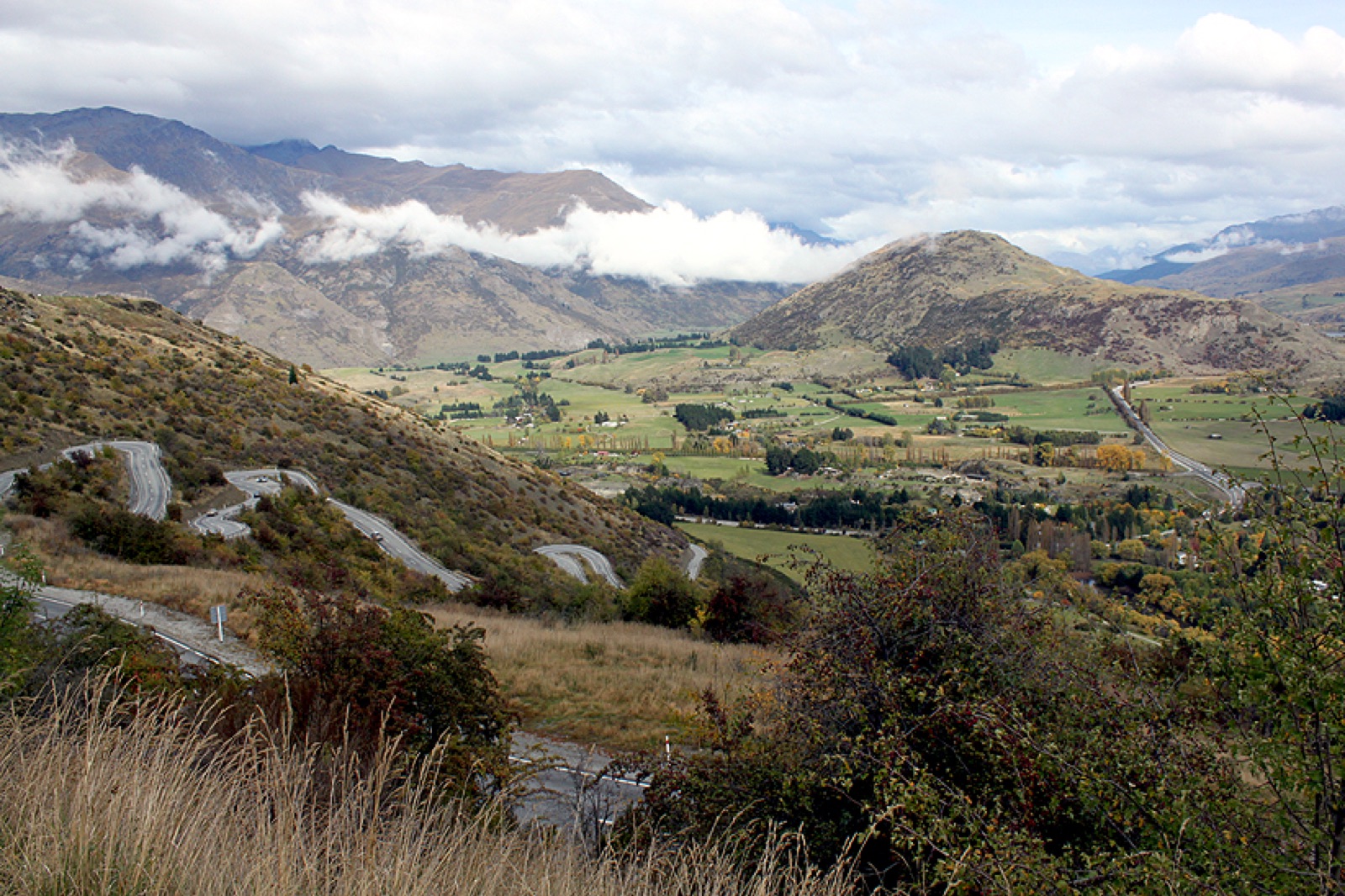

The Crown Range Road is the highest sealed main road in New Zealand at 1,076 metres. State Highway 89 climbs from Arrow Junction above Queenstown across the Crown Range to the Cardrona valley and Lake Wanaka beyond, replacing the long way round via the Kawarau Gorge with a steep, direct traverse of the high country.
History
The top six kilometres of the Crown Range were the last section of unsealed main highway in the South Island, paved only in 2001. The Queenstown side of the climb still follows the original packhorse route surveyed in the 1860s gold-rush era, and the Cardrona Hotel halfway down the northern descent, an 1863 pub with its original schist walls, has been in continuous operation since.
Riding it
From Queenstown, the climb begins at Arrow Junction and rises in a long traverse across the Crown Range face before a short switchback section takes the road to the summit. The northern descent into Cardrona is the gentler side, a steady drop through tussock and eventually sheep country into the Wanaka basin.
Maximum gradient is around 14% on the Queenstown side switchbacks. On a clear day the summit panorama reaches north to the Pisa Range and across to Aoraki/Mt Cook on the horizon.
Along the way
- Crown Range summit lookout — signed pullout at the top with interpretation panels and the classic view north to the Southern Alps.
- Cardrona Hotel — 1863 gold-rush pub on the northern descent, with an unchanged schist façade and a sheltered back garden.
- Cardrona Alpine Resort — ski field on a spur road off SH 89, popular winter day trip from Queenstown.
- Cardrona Bra Fence — roadside wire fence covered in bras, a long-running local landmark that has survived several council attempts to remove it.
- Haast Pass — the West Coast crossing of the Southern Alps, 140 km further north from Wanaka.
- South Island High Country loop — the three-pass circuit from Queenstown linking Crown Range, Haast, and Lindis.