India · Ladakh · Changthang
Umling La — 5,799 metres in eastern Ladakh
Profile of Umling La — 5,799m in eastern Ladakh, the second-highest motorable road in the world, built by India's Border Roads Organisation.

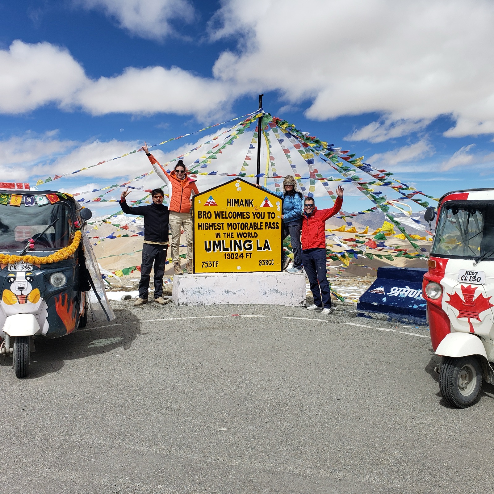
Umling La is the second-highest motorable road in the world at 5,799 metres (19,024 feet), on the Chisumle–Demchok road in eastern Ladakh. From 2017 to 2025 it held the Guinness World Record as the highest, until India's Border Roads Organisation completed the even higher Mig La road 40 kilometres north. Both roads were built by the same BRO unit.
History
The road follows a high-altitude corridor in the Changthang plateau a few kilometres from the Line of Actual Control with China. Construction was done in short summer seasons over three years; labourers worked at an oxygen level roughly 50% of sea-level values. The final stretch to the pass was asphalted in October 2017, and the Guinness certification followed in August 2021. The record stood for eight years before the BRO's Mig La road surpassed it in October 2025. The pass is named after the nearby Umling village.
Riding it
The pass sits 49 km from Chisumle and about 100 km from the nearest fuel at Hanle. Vehicles arriving from Leh typically take two days, with an acclimatisation stop at Hanle or Loma at around 4,300 m. Vehicle performance suffers dramatically above 5,500 m; carburetted bikes struggle most, and even modern fuel-injected engines lose roughly a third of their sea-level power.
The road itself is cleanly graded and paved end to end, with long straight sections across the plateau and a gentle final ramp to the summit. The view from the top takes in the Kailash range to the east and the high Changthang basin to the west.
Along the way
- Hanle village — the last reliable fuel stop, home to the Indian Astronomical Observatory at 4,500 m.
- Loma checkpost — the Inner Line Permit is checked here; foreign nationals and Indians both need prior paperwork.
- Umling La marker — the concrete plaque at the summit commemorating the 2021 Guinness certification, the usual photograph.
- Chisumle — small Border Roads hamlet at the south foot of the pass.
- Indo-Tibetan Border Police outpost — 4 km below the summit, staffed year-round.
- Mig La — the BRO's newer road 40 km north that took the world record in October 2025.